
Draw your farm
Find your address, then trace the boundary on satellite imagery and see the acreage straight away.
MyFarm is a web app for orchards and farm operations. Draw your farm on satellite imagery, map every tree, and keep field photos and field work in one place.
Tested on a 30-acre orchard with about 12,000 trees.
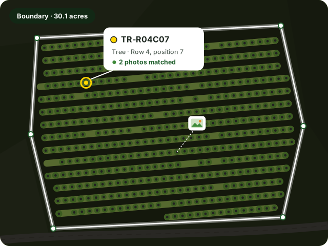
From the farm boundary down to a single tree, everything your team knows about the farm lives on one map.
Find your address, then trace the boundary on satellite imagery and see the acreage straight away.
Detect planted rows from aerial imagery, then place every tree on a named grid, such as TR-R04C07.
Upload geotagged field photos, and MyFarm attaches each one to the nearest tree or building.
Field crews and vendors get a text with a link to the job. There's no app to install.
One shared picture of the farm for everyone who looks after it.
See every farm, every task, and its status in one place.
Plan, assign, and verify work across farms.
Get a text with a link to the job. There's no app and no password.
Access to MyFarm is by invitation from a farm's owner or operations team.
MyFarm sends text messages for only two purposes:
Message frequency varies. Message and data rates may apply. Reply STOP to opt out or HELP for help. See our Privacy Policy and Terms of Service.
We'd like to hear about your farm. Email us and we'll get back to you.
info@greenties.farmGreen Ties LLC · Fremont, California